
Such an amazing and rewarding view from the summit but a grueling hike up to get there. In 2006 the BC Parks took claim to the 2,300 hectares of land that surrounds the rock face and to the east reaching back as far as Reeves lake. Believe it or not the trail is now much more hiker friendly than back in the day. The ascending and descending ropes have been replaced with switchbacks and a couple resting benches with view points have been added also. The hike however is heavily treed with no clear vista for the majority of your time other than a little peek-a-boo here and there. This journey will take you from 462 meters to 1150 meters above sea level. An elevation gain of approximately 700 meters in just 6.5 km to the main lookout.
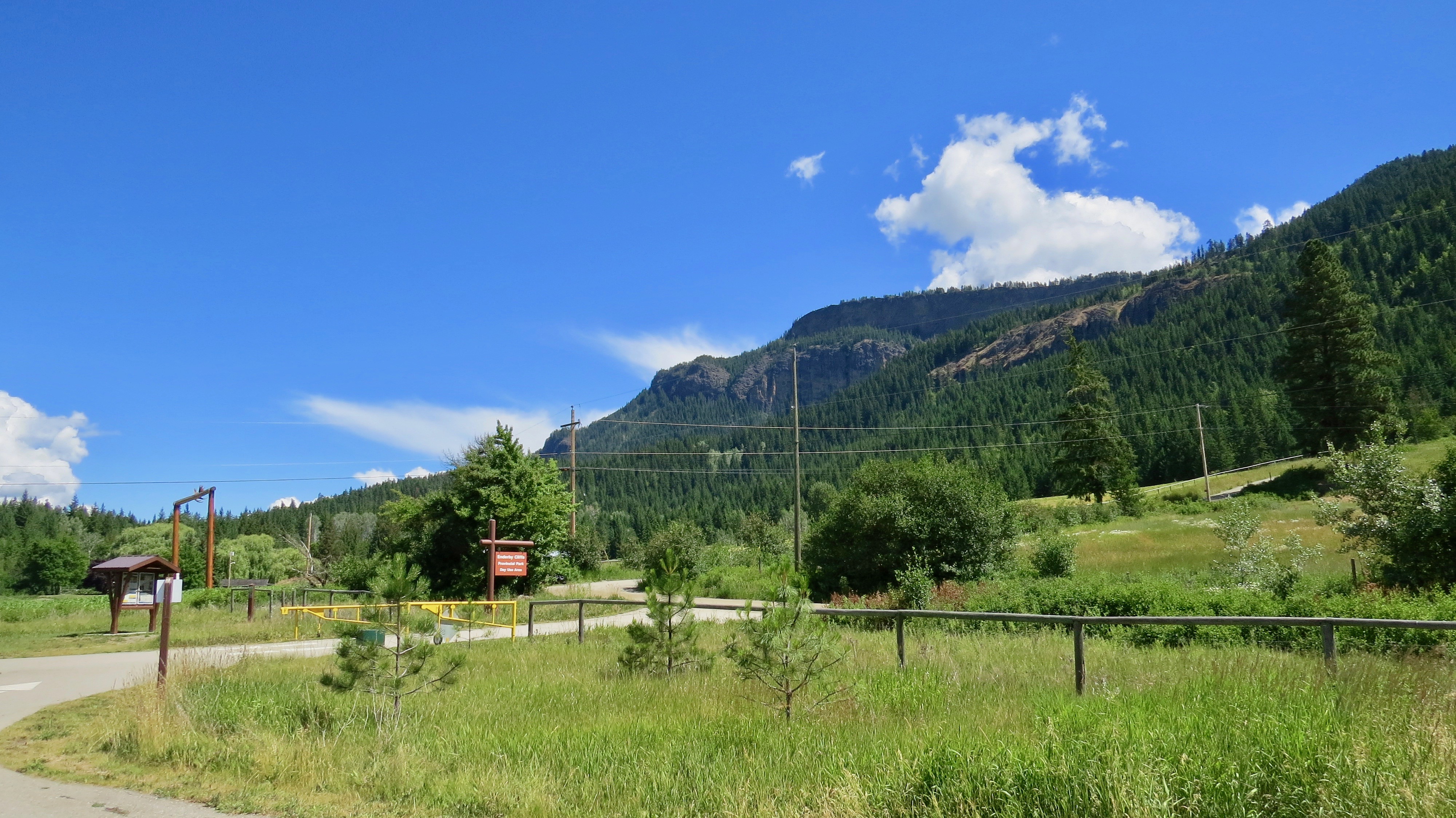
It starts off at a large paved parking lot equipped with outhouses and sign posts. You begin along side private property for the first 200 meters or so then duck into the forest. The double track meanders low for a bit before turning to a single track and starts to climb up and up to the first small lookout, around the 2 km mark. There is one more rest area and viewpoint at the 3 km mark before you head back into the trees and let the switchbacks take you to crest the plateau. Once you reach here the trees thin out a bit and the trail flattens down to a more friendly grade. A couple hundred meters further you will reach the cliff edge that you can walk along side of and find your perfect spot to stop, have a bite to eat and take on the views.

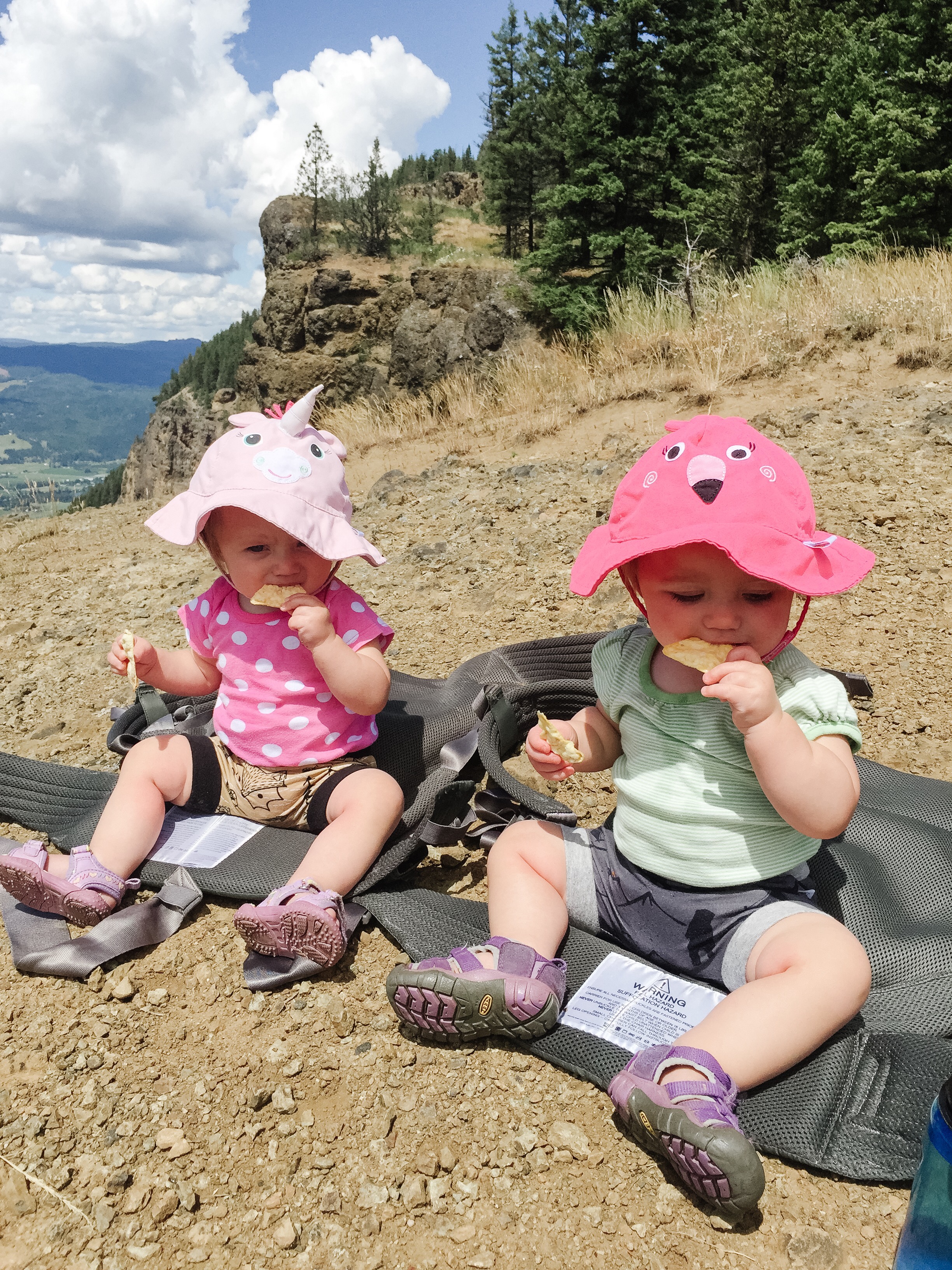
Our girls are quite the little troopers. Into our front Onya carriers they go and up to the top. They mostly take the lazy road and sleep the entire way saving their energy for the summit to race around and explore. Lidija really enjoys putting everything in her mouth so we try to keep her hands full with snacks rather then pine cones, rocks and dirt. Bexley just enjoys life. She doesn’t really sample the surroundings unless she notices Lidija getting our attention with doing so, then she follows suit.
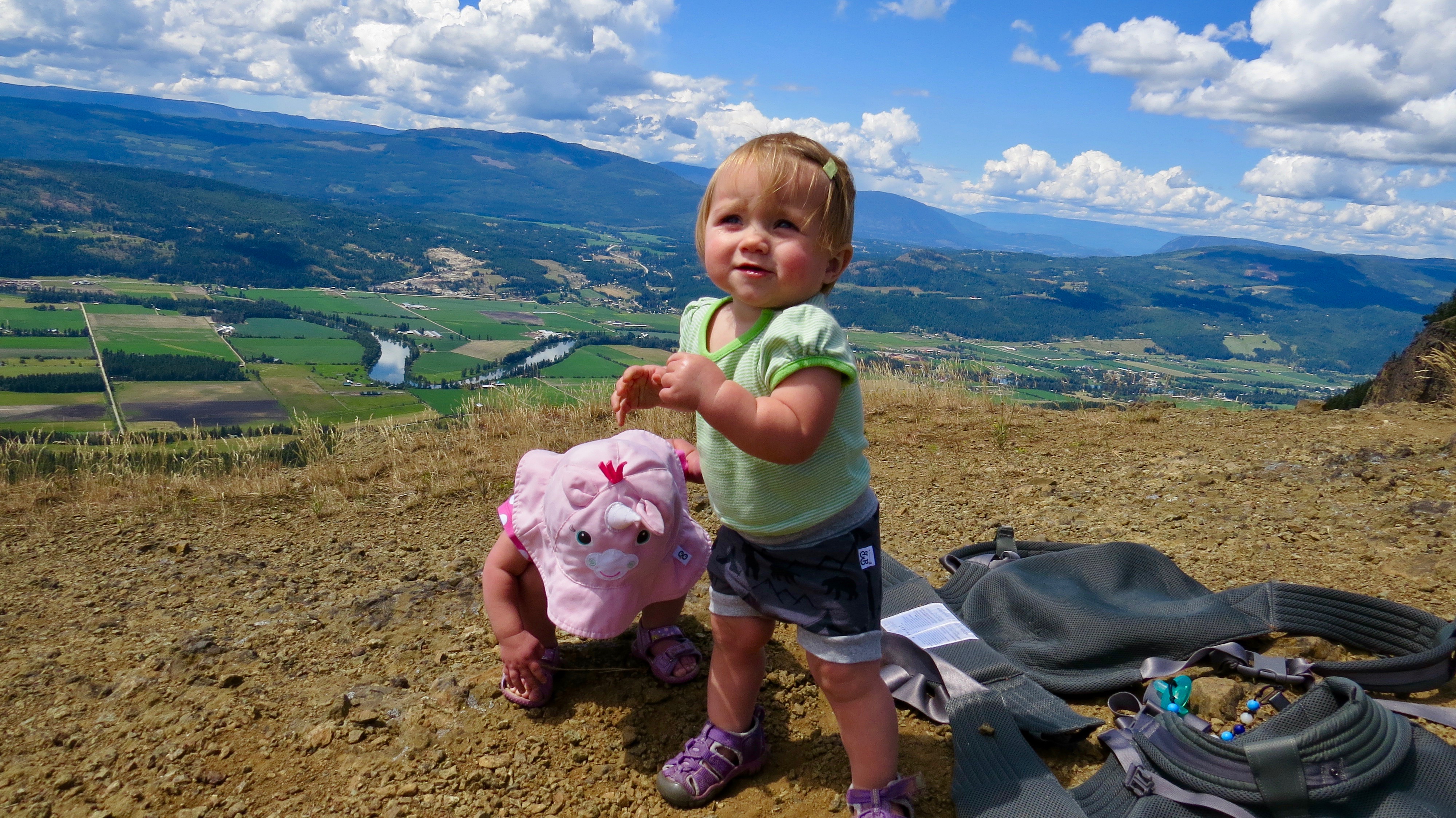
Being at the summit has leaves you very exposed not only to the drop of the cliff but also the afternoon sun and cooler winds that sweep up the rock face. There is no water access on this hike so be sure to bring plenty as you just might need it. The locals in the area never shy away from the climb so it is a very well used trail and the views from the top will show you why. Amazing mountain ranges, casual farmers fields and the flowing Shuswap river as it winds its way through the valley bottom.

If you are looking for something to compare it to we believe the Camels Hump outside Lumby and Bluenose Mountain near Lavington are similar trails, only with this climb it is twice as long and the path is better maintained. So if you have been tossing around the idea of getting out there, do not pass this one up as your efforts will leave you smiling and satisfied.

tandemgogo
Great pictures. Some of them made me feel a bit woozy.
LikeLike
Pingback: Farmstrong Cidery